-
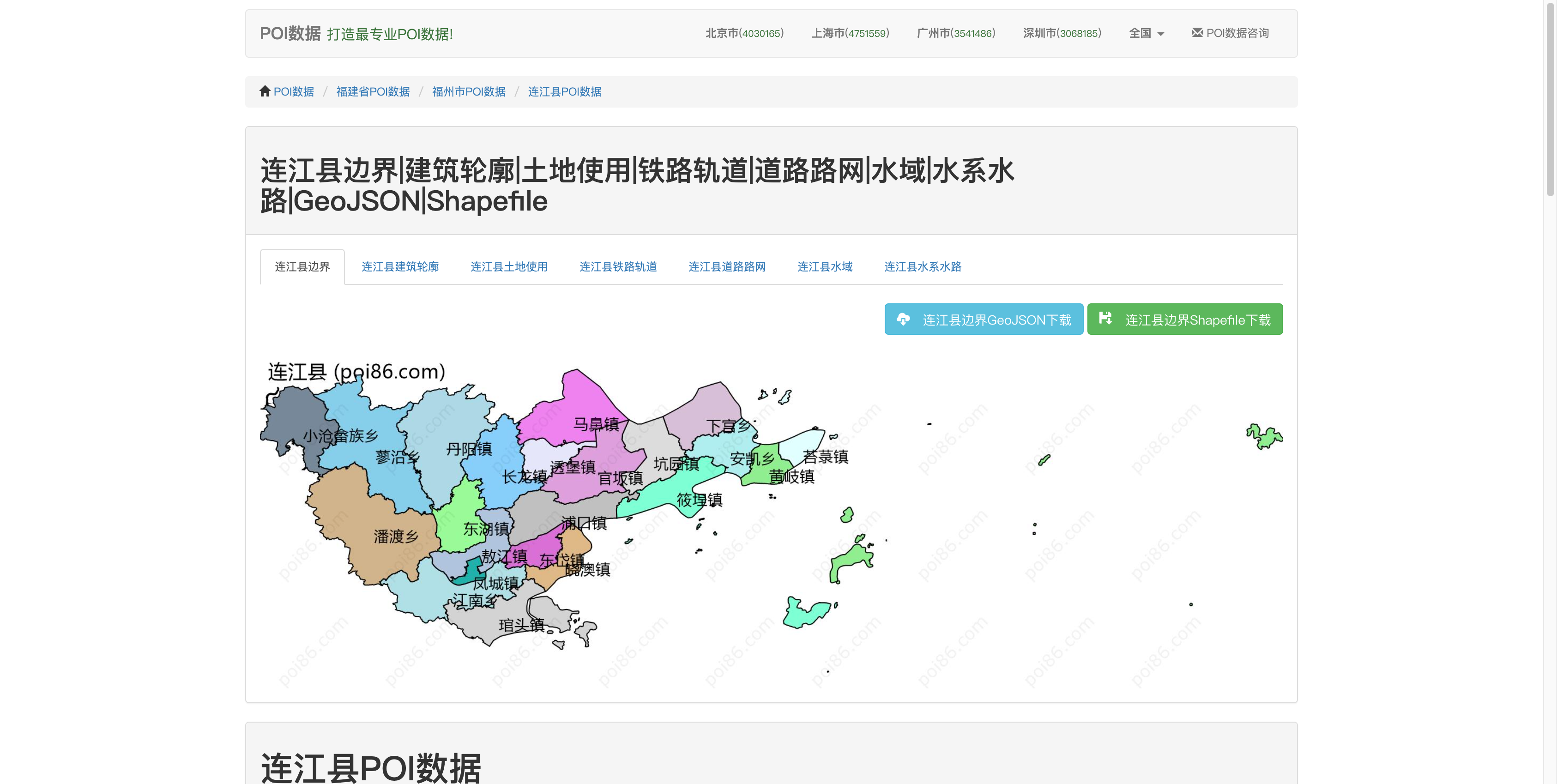
在 https://www.poi86.com/ (这个 POI 数据网站似乎国内不能访问。) 下载连江县地图数据 连江县边界 350122_GeoJSON(poi86.com)。zip !Pasted image 20240409140210.png
-
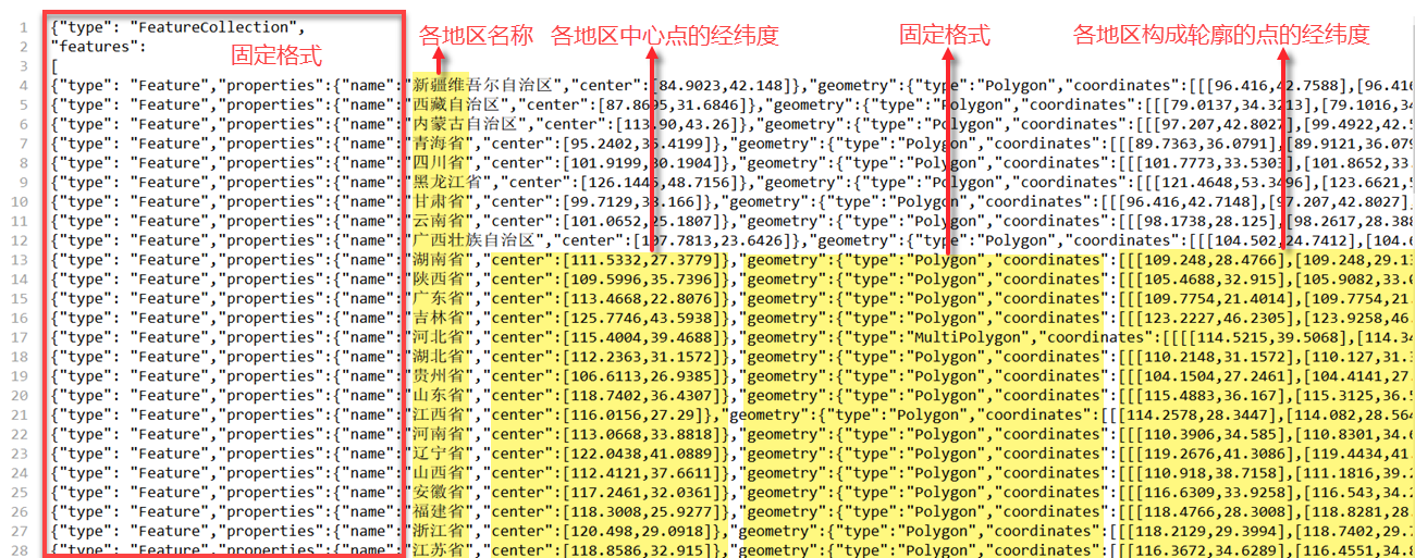
使用 Python 脚本添加中心点经纬度: 帆软自定义 geojson 地图的格式: !Pasted image 20240409140655.png
350122.geojson修改文件名350122-area.json
import json

def calculate_center(coordinates):
"""
计算多边形或多重多边形的中心点。
对于多边形,计算所有点的平均值。
对于多重多边形,对所有多边形执行相同的操作。
"""
total_x, total_y, count = 0, 0, 0
for part in coordinates:
 for polygon in part:
  for point in polygon:
   total_x += point[0]
   total_y += point[1]
   count += 1
return [total_x / count, total_y / count] if count else None

def add_centers_to_geojson(source_file_path, target_file_path):
"""
为 GeoJSON 文件中的每个要素添加中心点。
"""
with open(source_file_path, encoding="utf-8") as f:
 geo_data = json.load(f)

for feature in geo_data["features"]:
 center = calculate_center(feature["geometry"]["coordinates"])
 if center:
  feature["properties"]["center"] = center

with open(target_file_path, "w", encoding="utf-8") as f:
 json.dump(geo_data, f, ensure_ascii=False, indent=4)

print(f"修改后的 GeoJSON 文件已保存至: {target_file_path}")

# 使用函数处理文件

source_file_path = "350122-area.json"
target_file_path = "350122-modified-area.json"
add_centers_to_geojson(source_file_path, target_file_path)-
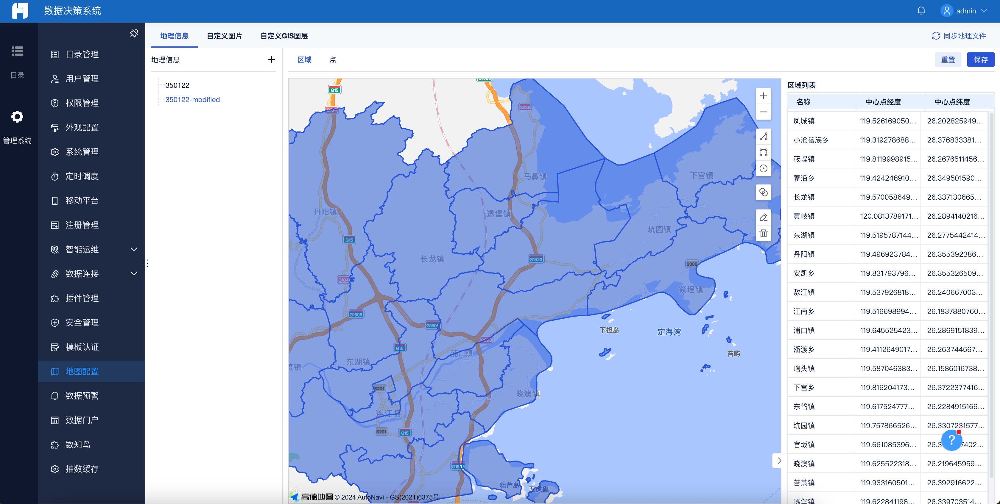
加载资源
- 将 JSON 文件放在工程 webapps\webroot\WEB-INF\assets\map\image 文件夹下
- 在数据决策系统中,点击 “管理系统>地图配置>同步地理文件” 即可。
参考:帆软的文档